80 WESTFORD ST
Owner Information
TOWN OF CARLISLE
80 WESTFORD STREET
CARLISLE, MA 01741


Property Details
80 WESTFORD ST is classified as a (formerly Municipalities/Districts. Removed June 2009.) (Fire stat).
The primary structure on this property was built in 1984. There are 14,089ft2 of built area within this property. There is 14,089ft2 of residential/living space within this property. There are 2 units within this property.
80 WESTFORD ST is valued at $2,434,100. The land is valued at $699,800 and the structures are valued at $1,734,300.
This property is in Zone A. Confirm with local Zoning Board authorities to ensure there are no overlays or other easements on this property.
80 WESTFORD ST was last sold on Tuesday, January 1, 1974 for $0.
Assessment data from fiscal year 2022.
Flood Data
According to the FEMA National Flood Hazard Layer, this property does not appear to be in a flood zone. It may also be in an area not yet reviewed. Nonetheless, confirm this information prior to taking any action.
To view the flood hazards around this property, create a FEMA "Firmette" Map of the area around 80 WESTFORD ST.
Broadband Internet Providers
| Provider | Type | Bandwidth (mbps) | |
|---|---|---|---|
| HughesNet | Satellite | 25 | 3 |
| PAETEC Communications, Inc | DSL | 0 | 0 |
| Comcast | Cable | 1000 | 35 |
| TPx Communications | Copper Wire | 0 | 0 |
| Verizon New England Inc. | DSL | 15 | 1 |
| Viasat Inc | Satellite | 100 | 3 |
| T-Mobile | Fixed Wireless | 25 | 3 |
| GCI Communication Corp. | Satellite | 0 | 0 |
| VSAT Systems, LLC. | Satellite | 2 | 1 |
Broadband service provider data from December 2020.
Adjacent Properties
- 65 LOWELL ST
Two-Family Residential owned by LEE ANNETTE - 48 WESTFORD ST
Telephone Exchange Stations owned by NEW ENGLAND TELEPHONE COMPANY - 0 LOWELL ST
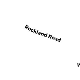
(formerly Municipalities/Districts. Removed June 2009.) owned by TOWN OF CARLISLE - 160 ROCKLAND RD
Single Family Residential owned by FARDY JR GEORGE W - 225 LOWELL ST
Single Family Residential owned by ANSARA MICHAEL - 0 OFF ROCKLAND RD
(formerly Municipalities/Districts. Removed June 2009.) owned by TOWN OF CARLISLE - 125 LOWELL ST
Single Family Residential owned by MOSCA JOHN J - 109 LOWELL ST
Single Family Residential owned by SIEDLAR DONNA J TRUSTEE - 75 LOWELL ST
Two-Family Residential owned by REDWING NOMINEE TRUST - 93 LOWELL ST
Single Family Residential owned by MADDEN SAMUEL